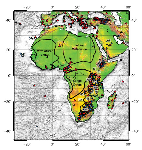
Figure 1. Station map modified from Emry et al. (2019). Cratons are outlined in thick black lines. Blue triangles denote stations for which ambient noise data were collected and red triangles show stations that were used to invert for tomography. Abbreviations are as follows: AF-Afar, AP-Arabian Peninsula, DB–Damara Belt, KpC–Kaapvaal Craton, LR–Luangwa Rift, MER–Main Ethiopian Rift, MR–Malawi Rift, OR–Okavango Rift, RVP–Rugwe Volcanic Province, SS–South Sudan, TC–Tanzania Craton, TD–Turkana Depression, VVP–Virunga Volcanic Province, ZC–Zimbabwe Craton.