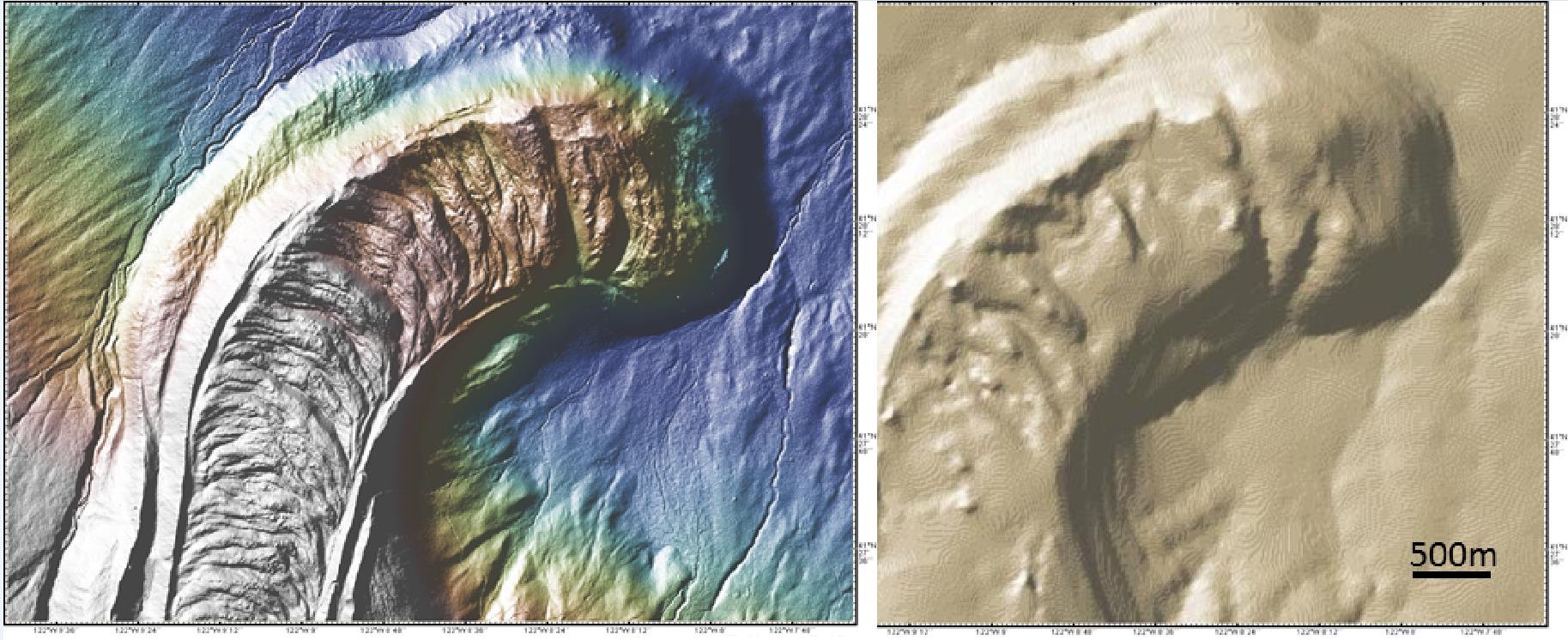
Figure 2. Mount Shasta’s Military Pass lava flow is shown in the 10m USGS National elevation Data set (right) and the newly-added ~3m LiDAR data set (left), plotted at the same scale. The LiDAR data is available in GeoMapApp under both the Focus Sites and the DataLayers menus. It provides a notable increase in resolution to reveal significantly more detail of field project areas as well as hiking trails and roads.