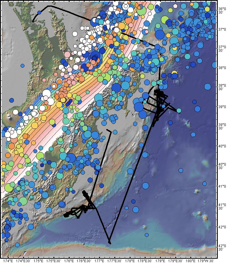
Figure 1. The bathymetric expression of the Hikurangi subduction zone lies to the east of New Zealand’s North Island. Here, the track line for the 2015 Revelle 2015 “STINGS” cruise (RR1508) is shown with the thick black line. The expedition surveyed both the northern part of the margin which is characterised by a creep-dominated subduction interface and shallow slow slip earthquakes (SSEs) and a southern area with deep SSEs. The 10km-contoured rainbow-coloured surface plotted on top of the North Island and trending NE-SW is the depth to the top of the subducting slab from the work of MARGINS/GeoPRISMS researchers Ellen Syracuse and Geoff Abers. Circles are the epicenters of earthquakes with magnitude > 4.5 for the period 1973-2009 from the USGS NEIC catalogue. They are coloured by depth (cool colours are shallow, warm are deeper) and scaled on magnitude. The follow-on “HOBITSS” cruise (RR1509) recovered instruments from the northern survey area. The image was created with GeoMapApp (http://www.geomapapp.org/) using the built-in geophysical data sets under the DataLayers menu and an imported track line for the cruise.