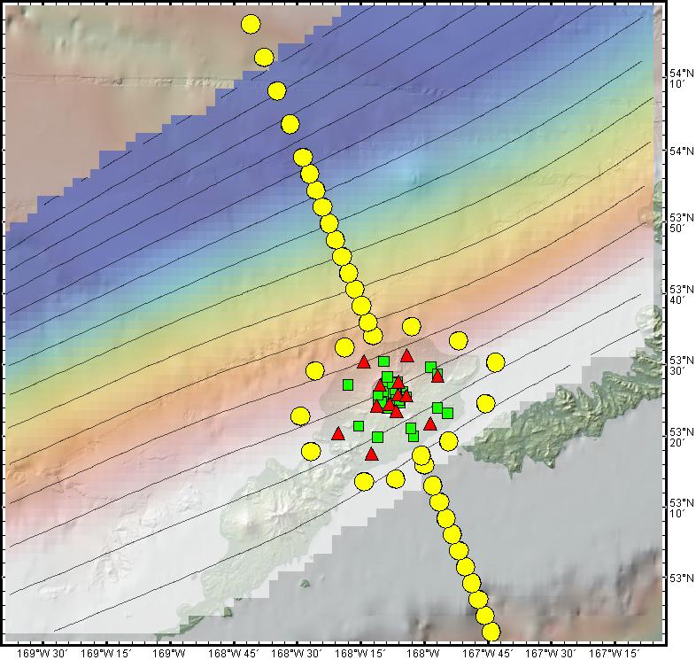
Figure 2. Instrument locations for MT devices offshore (yellow circles) and onshore (green squares) and for an array of 13 broadband seismometers (red triangles). The outline of Okmok island is visible in the background. The 10 km-contoured rainbow-colored semi-transparent surface plotted on top of the island and trending NE-SW depicts the depth to the top of the subducting slab from the work of MARGINS/GeoPRISMS researchers Ellen Syracuse and Geoff Abers. Image made with GeoMapApp.