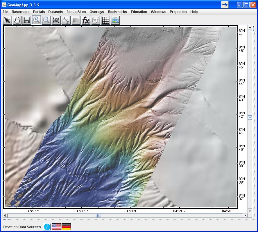
(b) A dense spacing of track lines was laid down for Langseth cruise MGL1106 – the CRISP 3-D multi-channel seismics Costa Rica experiment. With 4-5 overlapping sonar swaths, new processing methods were used by Kluesner and colleagues to generate highly-detailed bathymetry (medium) and backscatter (bottom) grids. The data sets were used to identify previously undocumented sites of potential fluid seeps associated with normal faults, and with bathymetric features such as pockmarks, mounds, ridges as well as with areas of high backscatter reflectance. In the GeoPRISMS/MARGINS integrated Data Portal, the data sets are linked to the Kluesner et al., 2013 G cubed paper. The map displays an area about 25 km across.