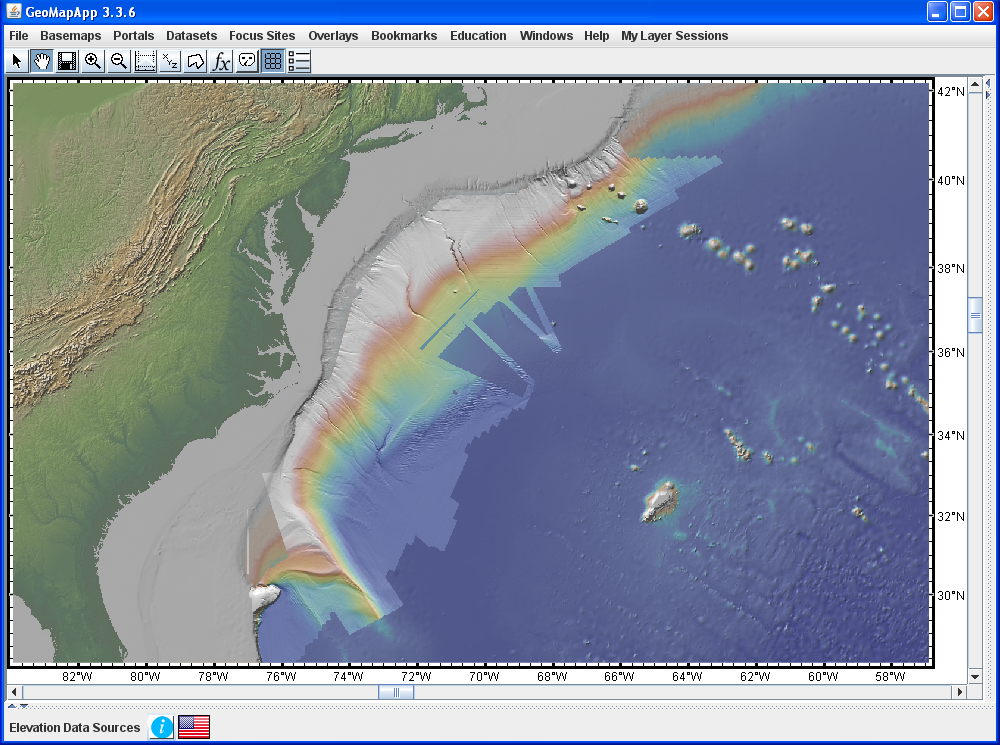
Figure 3. In GeoMapApp’s 3-D perspective viewer (lower right image), large ENE-WSW-trending current-generated sand waves with amplitudes of up to 150m are clearly visible in the built-in Law of the Sea bathymetry data. The perspective view is from the SW for the area shown by the red box, and artificial illumination is from the north. In the GeoMapApp map window (upper left), the full extent of the Law of the Sea bathymetry grid is made visible by the lighter hues along the margin. Law of the Sea backscatter data covers the same area. Onshore, high-resolution USGS NED elevation data delineates the Appalachians and coastal plains.