The GeoPRISMS data portal was established in 2011 to provide convenient access to data and information for each primary site as well as to other relevant data resources. Since the last newsletter report, highlighted below are recent contributions of data sets and field program information of interest to the GeoPRISMS community. Many of the data sets described are also available in GeoMapApp under the Focus Site and DataLayers menus.
Aleutian Arc
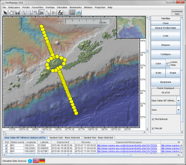
As part of a geophysical project to study the magmatic system beneath Okmok Volcano on the eastern Aleutian arc island of Umnak, offshore magneto-telluric (MT) time series data from the Key et al. 2015 amphibious project is now available. The offshore data was collected along a 300 km-long transect perpendicular to the subduction trench (Fig. 1). The MT stations comprised more than fifty broadband ocean-bottom electromagnetic receivers. All except one was recovered.
The data set is available here.
During the July 2018 Sikuliaq cruise SKQ201816S (chief scientists Geoff Abers and Doug Wiens) ocean-bottom seismometers were deployed in the Kodiak-Katmai region as part of the Alaska Amphibious Community Seismic Experiment (AACSE). New bathymetry data collected on that cruise has been added to the Global Multi-Resolution Topography (GMRT) synthesis which forms the base map used in GeoMapApp and in GMRT MapTool.
New Zealand
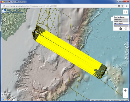
Multi-channel seismic shot field data and seismic navigation files were contributed by investigators Nathan Bangs, Shuoshuo Han, Greg Moore, Eli Silver, and Harold Tobin for the early 2018 Langseth active-source survey across New Zealand’s Hikurangi Margin. In this 3-D seismic survey, four streamer cables were towed close apart to generate the 15 km x 60 km survey outline across the trench and forearc shown in Fig. 2. The Hikurangi Margin is characterised by regularly-occurring slow-slip events (SSEs) and a main goal of the survey is to gain understanding of the factors associated with slow-slip behavior.
The seismic data sets are available here.


GeoPRISMS Data Portal Tools and Other Relevant IEDA Resources
Search For Data – The GeoPRISMS search tool provides a quick way to find GeoPRISMS data using parameters such as keyword, NSF award number, publications, and geographical extent.
Data Management Plan tool – Generate a data management plan for your NSF proposal. The on-line form can be quickly filled in, printed in PDF format, and attached to a proposal. PIs can use an old plan as a template to create a new plan. We have also developed a tool to help PIs show compliance with NSF data policies.
GeoPRISMS Bibliography – With more than 1,160 citations, many tied to data sets, the references database can be searched by primary site, paper title, author, year, and journal. Submit your papers for inclusion in the bibliography – just the DOI is needed!
Contribute Data – The web submission tools support PI contributions of geophysical, geochemical, and sample data. Once registered within the IEDA systems, the data sets become available to the broader community immediately or may be placed on restricted hold. Additionally, PIs can choose to have a DOI assigned to each submitted data set, allowing it to become part of the formal, citable scientific record. ■
