The GeoPRISMS data portal was established in 2011 to provide convenient access to data and information for each primary site as well as to useful data resources. Since the last newsletter report, the database group presented at the spring GeoPRISMS Steering and Oversight Committee meeting; had discussions with PIs about data products to be generated with their NSF awards; and, expanded the on-line GeoPRISMS bibliography to offer more than 700 citations, many linked to data. In GeoMapApp, EarthScope USArray station tables and EarthChem geochemistry analytical data sets were updated. And, as part of a summer series of in-depth GeoMapApp webinars recorded and placed on Youtube, one webinar showcased data sets and functionality relevant to the GeoPRISMS community. Highlighted below are some recent contributions of field program information and data sets of interest to the GeoPRISMS community.
Cascadia
Cascadia Initiative Year 3 OBS operations saw six OBS cruises take place between spring and autumn: three for recoveries followed by three for deployments. As in previous field seasons, the OBSs included shallow-water instruments designed to withstand fishing net trawls. Year 3 OBSs are expected to be picked up next year. Field program information and links to data for each Cascadia Initiative cruise are available via the GeoPRISMS data portal. Map-based OBS station information can be found in the GeoMapApp Focus Site menu as shown below.
There was continued focus on a bathymetric compilation for Cascadia. Version 2.5 of the Global Multi-Resolution Topography (GMRT) synthesis is used as the base map in GeoMapApp and incorporates cleaned sonar data from an additional 5 Cascadia cruises, including AT26-04, the summer 2013 Atlantis heat flux cruise run by Paul Johnson, Evan Solomon and Rob Harris.
Basic project outlines were also added to the portal for three other Cascadia projects: the summer 2012 Washington and Oregon onshore seismometer deployments of Anne Trehu and Geoff Abers in which airguns fired during R/V Langseth’s offshore seismic work (cruises MGL1211 and MGL1212) were recorded; and, lead PI Ken Creager’s inter-disciplinary, multi-institution iMUSH (Imaging Magma Under St. Helens) program.
ENAM
Conjugate to the Newfoundland margin, the West Iberia-Galicia margin was the site of a large-scale 3-D seismic survey during summer 2013.
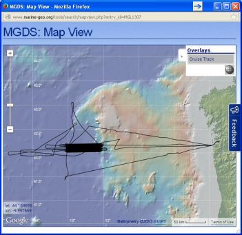
A two-ship experiment led by Dale Sawyer, Donna Shillington, Tim Reston, Cesar Ranero, Milena Marjanovic and Juli Morgan, cruise MGL1307 collected high-quality multi-channel and OBS data to study this magma-starved passive rifted margin (Fig. 2).
GeoPRISMS Data Portal Tools and Resources
Search For Data – The customised GeoPRISMS search tool provides a quick way to find GeoPRISMS data using parameters such as key word, NSF award number, publications, and geographical extent.
Data Management Plan tool – generate a data management plan for your NSF proposal – the on-line form can be quickly filled in, printed in PDF format and attached to a proposal. PIs can use an old plan as a template to create a new plan. We also have developed a tool to help PIs show compliance with NSF data policies.
GeoPRISMS Bibliography – With more than 700 citations, many tied to data sets, the references can be searched by primary site, paper title, author, year, and journal. The lists of publications can be exported to EndNote™. Submit your papers – just the DOI is needed – for inclusion in the bibliography!
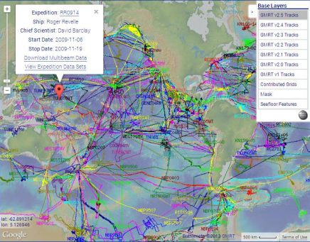
GeoMapApp – is a free map-based data exploration and visualization tool. Enhancements in version 3.3.8 include an improved interface for the PetDB portal, a more robust profiling tool, updates to support the import of data sets served via OGC WMS version 2, and an updated toolbar. Version 2.5 of the multi-resolution base map contains additional swath bathymetry for Cascadia and other areas. The GMRT portal map browser now allows users to explore the growth of the GMRT bathymetry synthesis with each new release by toggling track lines for each GMRT version, as shown below. A webinar held this past July focused on GeoPRISMS data sets and is available on the GeoMapApp channel. It shows how to generate custom maps, explore built-in data sets and import your own data.
Contribute Data – This updated web toolprovides a simple way to submit grid files, tabular data sets, spreadsheets, and shapefiles. Once added to the GeoPRISMS database, these data sets become available to the broader community immediately or can be placed on restricted hold.
GeoPRISMS MediaBank – Please send compelling images, including photos from your field expeditions, for inclusion in the gallery!


