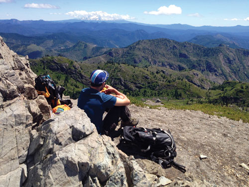
Carl Ulberg (University of Washington) and members of the iMUSH field team
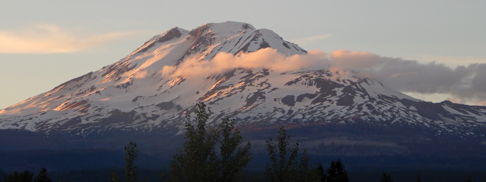
The imaging Magma Under St. Helens (iMUSH) experiment is a collaborative research project involving several institutions with an aim to illuminate the magmatic system beneath Mount St. Helens, WA, from the slab to the surface. A variety of geophysical imaging techniques (magnetotelluric, active-source, and passive-source seismology) are being used in conjunction with geochemical and petrologic data to image and interpret the crust and upper mantle in the greater Mount St. Helens (MSH) area. All components of the project were underway during the 2014 field season, deploying instruments and collecting data. The active source experiment successfully set off 23 shots, recording data at about 6000 sites in late July and early August. Magnetotelluric measurements were made at 40 sites during the summer of 2014 and many rocks were collected and analyzed. The passive source seismic deployment occurred between June 16 and July 2, and involved installing 70 broadband seismometers in a ~50 km radius around MSH. The following sections detail the passive seismic deployment.
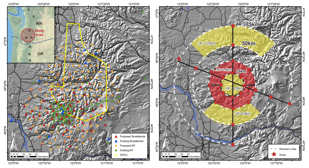
Figure 1. Proposed project map showing deployment locations of passive source seismic imaging and magnetotelluric survey (left) and active source tomography (right) in the greater Mount St. Helens area. For the active part (right), black lines are refraction profiles, each with 8 shots (red stars) and 1000 Texans. Colored areas are areal areas, each containing 1600 Texans.
June 16-June 22: Kelso, Organizing
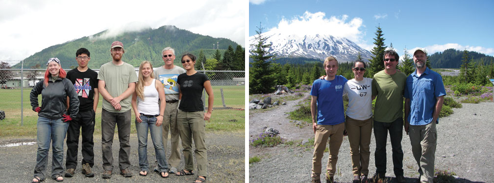
18 people descended on an airport hangar in Kelso, WA, to begin the passive deployment. After a couple of days training on the instruments and installation procedures, buying materials and getting them ready, we headed out to begin the installations. We started out in two large groups to learn the ropes, then began to split into teams of two to three to install further sites.
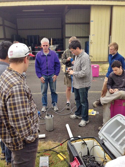
Figure 2. The participants practicing seismic station setup in Kelso, WA. Photo credit: Seth Moran
A Day in the Life (by Steve Malone)
After a late night the evening before with the PIs (Principle Investigators) “strategizing” about what should next be done, it is an early morning departure. After a half hour drive one team realizes they don’t have the maps for where they are going and must return to the motel to pick them up. Another team has a flat tire on some very rough roads and must return on the spare to get it fixed…a good thing since later in the day they have another flat (different tire) so really needed that spare. Using a combination of written instructions, road maps, Forest Service maps, private timber company maps, a laptop computer with mapping software, a compass and a GPS the team finds its way to its assigned installation site which has been investigated and permitted sometime in the last couple of years. Now it is time to really get to work.
Equipment is hauled from the truck several hundred meters to the actual site, in multiple trips. Discussions, opinions and arguments issue between the two PIs in this team over exactly where the best place for the vault should be. It must be away from tall trees, in ground that can be dug but as close to bedrock as the site provides. In the meantime the hole is dug by hand by Alicia, who just graduated with a PhD and has forgotten that she should leave the digging to current grad students and participate in the PI discussions.
The actual sensor is very sensitive and must be handled with care even when its moving parts are locked for transport. Once installed on the small concrete pier in the bottom of the hole and cables attached it can be unlocked. At this point the sensor is very vulnerable to damage if moved.
In the meantime another team is working on other parts of the station installation. Many sites will be powered by solar panels. Because of the elevation and winter weather they must be installed on a mast to get them above the likely snow depth, sometimes as much as four meters deep in late winter. The mast consists of a wood post buried up to a meter with a sectional pipe bolted to it.
Once all of the heavy work is done it is time to make all the connections and test the system. A rat’s nest of wires and cables in the equipment box connects the various components. The seismometer cable comes in through a PVC pipe and power cable is protected from animals with a wire mesh screen. A seismometer control box allows for testing, unlocking and centering the seismometer even without a datalogger. The datalogger gets timing information from a specialized GPS antenna. A regular iPod with special software and cable is used to configure, initialize and test the datalogger. In one case the team forgot the iPod in the equipment box and had to drive all the way back to the site the next day to retrieve it.
Near the end, with only back filling and covering the vault and cleaning up left to do the site is a mess of tools, equipment boxes, shipping containers and water jugs. Once all of this is hauled back to the truck the site should be relatively inconspicuous.
Other Distractions
Initial sites were on the west side of MSH in a lot of timber land and we quickly found our tires weren’t up to the task. We got over ten flats split between six vehicles and thankfully no one ever got stuck, although there were at least two cases of a full flat plus another slow leak where the vehicle was able to make it back to town in time.
The World Cup was happening at the same time so some people used creative means to catch a game, although for the most part we were resigned to learn the results when we returned at night (those of us who cared, that is). Turned out sitting in a tire store waiting for a flat to be fixed was a good way to spend the morning. One team had the luck of a wet mix of concrete, which of course called for eating lunch in town (somewhere with a TV!) waiting for it to dry. Or getting a site where there was still radio reception- sitting in the car for 15 minutes to listen to the US fall to Belgium while your partner digs a hole in the blazing heat isn’t so bad, is it?
June 22-June 29: Split up- Trout Lake vs. Randle
After a week based out of the relatively civilized Kelso, WA, the group split into two smaller teams to venture east into the boonies. So the race began between Team Randle and Team Trout Lake.
In Randle, many of the sites were on Forest Service land, with much longer drive times. We began with eight people and dwindled down to five over the next week as other commitments took people away. These were long days with a lot of driving. We used slow-drying cement (the only kind available) the first day, so that delayed things a little bit, since it required returning several days later to finish the installation. Thankfully we had no flats. We were staying in a combination motel/bar/restaurant, and it was the only place we ate dinner for almost a week. It had some variety at least, and a warped pool table, jukebox, and karaoke. Internet service was limited so we had to learn to enjoy each others company instead.


Compared to Randle, Trout Lake initially sounded like a breeze. Great progress was made every day, there were two (!) places to eat at night, and teddy bears on the beds. Not everything was fun and games, however…
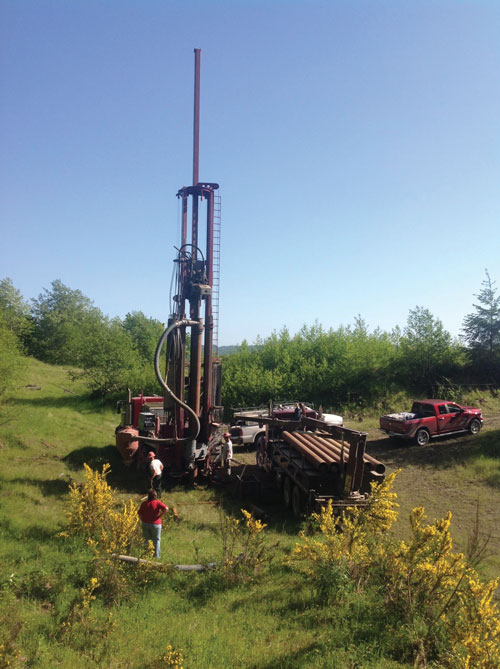
After a week further afield, the remaining participants returned to Kelso to finish up the installs on the west side of the volcano. By this time we were all seasoned pros. Combine that with fewer sites and fewer people to keep track of, and we were able to make quick work of the remaining sites and return home to celebrate the Fourth of July, until some of us returned a couple weeks later to service the instruments before the active seismic experiment began shooting. Drilling a shothole The iMUSH active seismic experiment was fielded from instrument centers established in the gymnasiums of public schools in the towns of Castle Rock, Woodland, and Carson, Washington. A group of 55 volunteers and four PASSCAL field technicians deployed about 2500 Texan recorders in two deployments. A dozen UNM volunteers and Nodal Seismic personnel fielded the Nodal Seismic recorders. Over 1100 instruments were hiked into the Mount St. Helens National Monument. UTEP personnel from the National Seismic Source Facility oversaw drilling and loading the 23 shotholes, and detonating the explosions. The field operations were preceded by twelve weeks of surveying and permitting. The experiment extended across the Gifford Pinchot National Forest and lands belonging to four timber companies and the State of Washington, requiring permits from fifteen public and private organizations. In addition to excellent recordings of the shots, the iMUSH active source instruments recorded dozens of local earthquakes. The iMUSH magnetotelluric (MT) deployments were staged from Oregon State University, in Corvallis, OR, with a forward operating base in Portland, OR. A total of 40 MT stations were completed in 2014, 97 additional stations were permitted, and 13 remain to be permitted in 2015. MT field crew participants included a USGS team led by Jarod Peacock and Lyndsay Ball, who did the major 2014 push, and an OSU team led by Myle McDonald, who installed iMUSH sites in the Fall of 2014 until the end of the field season. MT work is seasonal and is usually initiated when the ground is clear of snow and ends when snowfall becomes a significant operating concern. The 2014 field operations were limited by the number of instruments that operated with reliable firmware and the number of magnetic field seasons. The 2015 field season is about to get underway, with OSU taking up the initial installations, and USGS anticipated to resume operations later in the field season. For 2015 operations, the number of wideband MT instruments will increase from four to ten and two field crews will operate simultaneously for much of the field season. Deploying Texans on foot around Mount St. Helens “Report from the Field” was designed to inform the community of real-time, exciting GeoPRISMS -related research. Through this report, the authors expose the excitement, trials, and opportunities to conduct fieldwork, as well as the challenges they may have experienced by deploying research activities in unique geological settings. If you would like to contribute to this series and share your experience on the field, please contact the GeoPRISMS Office at info@geoprisms.nineplanetsllc.com. This opportunity is open to anyone engaged in GeoPRISMS research, from senior researchers to undergraduate students. GeoPRISMS Newsletter, Issue No. 34, Spring 2015. Retrieved from http://geoprisms.nineplanetsllc.com
One of the nuts on the solar panel mount was double threaded, so Tim and Roger had to saw it off. We also forgot to undo the solar panel cable before erecting the mast, so Tim got up on Ben’s shoulders to reach it. Dinner in Hood River tonight. We earned it. Whoot!Alicia Hotovec-Ellis, UW post-docJune 29-July 2: Finishing up, Kelso
July 15-August 5, 2014: Active Seismic Experiment
Spring-Fall, 2014: Magnetotelluric Deployment
We hope to hear from you!